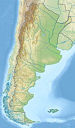
马尔莫莱霍火山
外观
| 马尔莫莱霍火山 | |
|---|---|
 | |
| 最高点 | |
| 海拔 | 6,108米 |
| 坐标 | 33°43.071′S 69°51.812′W / 33.717850°S 69.863533°W |
| 地理 | |
| 位置 | |
| 所属山脉 | 安第斯山脉 |
| 地质 | |
| 山脉类型 | 层状火山 |
| 最近喷发 | 不详 |
马尔莫莱霍火山(Cerro El Marmolejo)是南美洲安第斯山脉的层状火山,位于阿根廷和智利的接壤边境,高度6,108米,是全世界高于6,000米高山中最南端的山峰。
外部链接
[编辑]- SI Google Earth Placemarks (页面存档备份,存于互联网档案馆) - Smithsonian Institution Global Volcanism Program: download placemarks with SI Holocene volcano-data.
参考文献
[编辑]- San José. 全球火山作用计划. 史密森尼学会. (includes Marmolejo)
- González-Ferrán, Oscar. Volcanes de Chile. Santiago, Chile: Instituto Geográfico Militar. 1995: 640 pp. ISBN 956-202-054-1. (in Spanish; also includes volcanoes of Argentina, Bolivia, and Peru)
- Biggar, John. The Andes: A Guide for Climbers (3rd ed.). Andes Publishing (Scotland). 2005: 304 pp [2010-04-13]. ISBN 0-9536087-2-7. (原始内容存档于2015-04-20). (页面存档备份,存于互联网档案馆)
| 这是一篇与美洲地理相关的小作品。您可以通过编辑或修订扩充其内容。 |

