伊万尼察
外观
| 伊万尼察 Ивањица Ivanjica | |
|---|---|
| Town and municipality | |
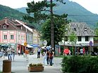
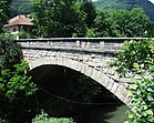
Clockwise, from top: Town panorama, "Stone Bridge", town center promenade | |
| 词源:Saint John's Eve (塞尔维亚语:Ивањдан) | |
| 坐标:43°34′52″N 20°13′47″E / 43.58111°N 20.22972°E | |
| 国家 | |
| 区域 | 舒马迪亚和塞尔维亚西部 |
| 州 | 莫拉瓦州 |
| 定居点 | 49 |
| 村庄状态 | 1833年[1] |
| 城镇状态 | 1866年6月16日[2] |
| 政府 | |
| • 市长 | Momčilo Mitrović (SNS) |
| 面积[3] | |
| 面积排名 | 8th in Serbia |
| • Town | 3.68 平方公里(1.42 平方英里) |
| • Municipality | 1,089.70 平方公里(420.74 平方英里) |
| 海拔 | 468 米(1,535 英尺) |
| 最高海拔 (Jankov Kamen peak) | 1,833 米(6,014 英尺) |
| 人口(2011)[4] | |
| • 排名 | 50th in Serbia |
| • Town | 11,715 |
| • Town密度 | 3,183人/平方公里(8,245人/平方英里) |
| • Municipality | 31,963 |
| • Municipality密度 | 29.3人/平方公里(76人/平方英里) |
| 时区 | CET(UTC+1) |
| • 夏时制 | CEST(UTC+2) |
| 邮政编码 | 32250 32251 32252 32253 32254 32255 32256 32258 32259 |
| 电话区号 | +381(0)32 |
| 车辆号牌 | IC |
| 网站 | www |
伊万尼察(塞尔维亚语西里尔字母:Ивањица;塞尔维亚语拉丁字母:Ivanjica)是塞尔维亚的城镇,由莫拉瓦州负责管辖,位于该国西南部,面积1,090平方公里,受大陆性气候影响,该镇自1930年代是疗养胜地,2011年人口11,810。
参考资料
[编辑]- ^ IVANJICA. srbijanac.rs. [18 December 2016]. (原始内容存档于20 December 2016).
- ^ Položaj (Ivanjica). wpsajt.ivanjica.gov.rs. [18 December 2016]. (原始内容存档于2016-12-20).
- ^ Насеља општине Ивањица (PDF). stat.gov.rs. Statistical Office of Serbia. [12 October 2019]. (原始内容 (PDF)存档于2015-11-14) (塞尔维亚语).
- ^ 2011 Census of Population, Households and Dwellings in the Republic of Serbia: Comparative Overview of the Number of Population in 1948, 1953, 1961, 1971, 1981, 1991, 2002 and 2011, Data by settlements (PDF). Statistical Office of Republic Of Serbia, Belgrade. 2014 [2014-06-27]. ISBN 978-86-6161-109-4.
外部链接
[编辑]- Website of Ivanjica (英文)
- Ivanjica (英文)
- Mineral Water produced in Ivanjica (英文)
- Institute for Specialised Rehabilitation (页面存档备份,存于互联网档案馆) (塞尔维亚文)
| 这是一篇与塞尔维亚地理相关的小作品。您可以通过编辑或修订扩充其内容。 |


