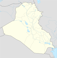
舒魯帕克
外觀
31°46′38.51″N 45°30′35.14″E / 31.7773639°N 45.5097611°E
| 舒魯帕克 舒路帕克 | |
|---|---|
| 坐標:31°46′39″N 45°30′35″E / 31.777363888889°N 45.509761111111°E |
舒魯帕克(蘇美語:𒋢𒆳𒊒𒆠 ŠuruppagKI),伊拉克古城,即今法拉赫丘,位於今伊拉克中南部的尼普爾附近。原址建於幼發拉底河畔。20世紀初期經過考古發掘證明該遺址的年代為史前後期至烏爾第三王朝(約公元前2112年至約公元前2004年),在當時存在着一個高度發達的社會。蘇美爾神話中的大洪水即發生於此地。[1]
註釋
[編輯]- ^ Francesco Pomponio, Giuseppe Visicato, Aage Westenholz, Harriet P. Martin, The Fara Tablets in the University of Pennsylvania Museum of Archaeology and Anthropology, CDL Press, 2001, ISBN 1-883053-66-8
擴展閱讀
[編輯]- Francesco Pomponio, Giuseppe Visicato, Aage Westenholz, Harriet P. Martin, The Fara Tablets in the University of Pennsylvania Museum of Archaeology and Anthropology, CDL Press, 2001, ISBN 1-883053-66-8
- R. J. Matthews, Fragments of Officialdom from Fara, Iraq, vol. 53, pp. 1–15, 1991

