布恩迪難以穿越的國家公園
外觀
| 布恩迪難以穿越的國家公園 | |
|---|---|
 | |
| 位置 | 烏干達 |
| 座標 | 01°01′S 29°41′E / 1.017°S 29.683°E |
| 面積 | 331km2 |
| 建立 | 1991 |
| 管理機構 | 烏干達野生動物管理局 |
| 官方名稱 | 布恩迪難以穿越的國家公園 |
| 位置 | |
| 標準 | 自然:(vii)(x) |
| 參考編碼 | 682 |
| 登錄年份 | 1994年(第18屆會議) |
| 面積 | 32,092公頃(79,300英畝) |
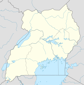
布恩迪難以穿越的國家公園(Bwindi Impenetrable National Park)位於東部非洲烏干達西南部,東非大裂谷西部邊緣,靠近剛果民主共和國邊境線處的維龍加國家公園。布恩迪難以穿越的國家公園是布恩迪難以穿越森林的一部分,於1994年列入聯合國教科文組織世界遺產名錄。[1]
生物
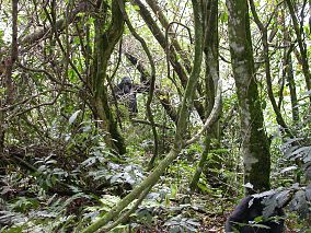
[編輯]布恩迪難以穿越的國家公園是疣猴、黑猩猩和例如蕉鵑、犀鳥等鳥類的家園。值得注意的是,國家公園內擁有將近世界現存一半的山地大猩猩(部分研究稱其為一個單獨的亞種,布恩迪大猩猩)。[2]
登錄基準
[編輯]該世界遺產被認為滿足世界遺產登錄基準中的以下基準而予以登錄:
- (vii)包含出色的自然美景與美學重要性的自然現象或地區。
- (x)擁有最重要及顯著的多元性生物自然生態棲息地,包含從保育或科學的角度來看,符合普世價值的瀕臨絕種動物種。
參考資料
[編輯]- ^ Bwindi Impenetrable National Park profile (頁面存檔備份,存於互聯網檔案館) on UNESCO's World Heritage website
- ^ Mountain Gorilla Population Rebounds in Uganda. LiveScience.com. [2007-05-03]. (原始內容存檔於2008-07-04).
參考書目
[編輯]- Blomley, Tom. Natural resource conflict management: the case of Bwindi Impenetrable and Mgahinga Gorilla National Parks, southwestern Uganda (PDF). Peter A. Castro, Erik Nielsen (編). Natural resource conflict management case studies: an analysis of power, participation and protected areas (PDF). Rome: Food and Agriculture Organization of the United Nations. 2003.[永久失效連結]
- Korbee, Dorien. Environmental Security in Bwindi: A focus on farmers (PDF). Institute for Environmental Security. March 2007 [2008-07-08]. (原始內容 (PDF)存檔於2008-08-30).
- Namara, Agrippinah. From Paternalism to Real Partnership with Local Communities? Experiences from Bwindi Impenetrable National Park (Uganda). Africa Development. June 2006, XXXI (2): 39–68.
外部連結
[編輯]維基共享資源上的相關多媒體資源:布恩迪難以穿越的國家公園
- Bwindi Forest National Park(頁面存檔備份,存於互聯網檔案館), BwindiForestNationalPark.com
- Bwindi Impenetrable National Park: Bwindi Mgahinga Conservation Trust, bwinditrust.ug
- Bwindi Impenetrable National Park(頁面存檔備份,存於互聯網檔案館), UNESCO World Heritage Site listing
- Bwindi Impenetrable National Park: Bwindi Community Hospital, BCHC
- Bwindi Impenetrable National Park: Conservation Through Public Health (頁面存檔備份,存於互聯網檔案館), ctph.org


