洛亞諾克 (維吉尼亞州)
外觀
37°16′N 79°56′W / 37.267°N 79.933°W
| 羅阿諾克 Roanoke | |
|---|---|
| 獨立市 | |
| 綽號:The Star City of The South, Magic City, Star City | |
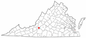
 洛亞諾克在維吉尼亞州的位置 | |
| 坐標:37°16′14″N 79°56′33″W / 37.2706°N 79.9425°W | |
| 國家 | |
| 州 | |
| 縣 | 無(獨立市) |
| 語源 | 羅阿諾克河 |
| 政府 | |
| • 類型 | 議會-經理制政府 |
| • 市長 | 謝爾曼·P·莉亞 |
| 面積[1] | |
| • 獨立市 | 42.85 平方英里(110.99 平方公里) |
| • 陸地 | 42.52 平方英里(110.13 平方公里) |
| • 水域 | 0.33 平方英里(0.86 平方公里) |
| 海拔[2] | 974 英尺(297 公尺) |
| 人口(2020年) | |
| • 獨立市 | 100,011人 |
| • 密度 | 2,334人/平方英里(901人/平方公里) |
| • 市區 | 217,312 |
| • 市區密度 | 1,731.6人/平方英里(668.6人/平方公里) |
| • 都會區 | 315,251 |
| 時區 | EST(UTC-5) |
| • 夏時制 | EDT(UTC-4) |
| 郵遞區號 | 24001–24020, 24022–24038, 24040, 24042–24045, 24048, 24050, 24155, 24157, 24012 |
| 電話區號 | 540, 826 |
| FIPS代碼 | 51-77000[3] |
| GNIS ID | 1499971[4] |
| 網站 | www |
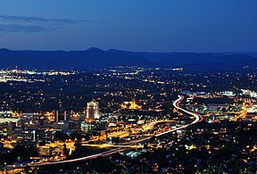
羅阿諾克(英語:Roanoke)是美國弗吉尼亞州西南部的一個獨立市,面積111.4平方公里。根據2020年美國人口普查,共有人口10萬11人,是弗吉尼亞州第8大城市、州府里士滿以西的最大城市。
地理
[編輯]| 弗吉尼亞州羅亞諾克–布萊克斯堡地域機場(1991–2020年正常值,1912年至今極端數據) | |||||||||||||
|---|---|---|---|---|---|---|---|---|---|---|---|---|---|
| 月份 | 1月 | 2月 | 3月 | 4月 | 5月 | 6月 | 7月 | 8月 | 9月 | 10月 | 11月 | 12月 | 全年 |
| 歷史最高溫 °C(°F) | 27 (81) |
29 (84) |
32 (90) |
35 (95) |
37 (99) |
40 (104) |
41 (105) |
41 (105) |
39 (103) |
37 (99) |
28 (83) |
27 (80) |
41 (105) |
| 平均最高溫 °C(°F) | 19.6 (67.2) |
21.3 (70.3) |
25.8 (78.5) |
29.8 (85.7) |
31.9 (89.5) |
34.2 (93.6) |
35.4 (95.8) |
34.7 (94.5) |
32.9 (91.2) |
29.2 (84.6) |
24.4 (76.0) |
20.2 (68.3) |
36.1 (96.9) |
| 平均高溫 °C(°F) | 8.4 (47.1) |
10.4 (50.8) |
15.0 (59.0) |
20.9 (69.7) |
25.1 (77.2) |
29.1 (84.4) |
31.2 (88.1) |
30.3 (86.5) |
26.7 (80.0) |
21.2 (70.1) |
15.0 (59.0) |
10.0 (50.0) |
20.3 (68.5) |
| 平均低溫 °C(°F) | −1.8 (28.7) |
−0.7 (30.8) |
3.1 (37.6) |
7.9 (46.3) |
12.8 (55.0) |
17.3 (63.2) |
19.7 (67.4) |
18.9 (66.0) |
15.1 (59.1) |
8.8 (47.8) |
3.2 (37.7) |
−0.1 (31.8) |
8.7 (47.6) |
| 平均最低溫 °C(°F) | −11.7 (11.0) |
−9.3 (15.3) |
−6.1 (21.0) |
−0.5 (31.1) |
4.5 (40.1) |
10.8 (51.4) |
14.3 (57.8) |
13.4 (56.1) |
7.4 (45.4) |
0.2 (32.4) |
−4.7 (23.6) |
−8.3 (17.0) |
−12.8 (9.0) |
| 歷史最低溫 °C(°F) | −24 (−11) |
−18 (−1) |
−13 (9) |
−9 (15) |
−1 (30) |
2 (36) |
8 (47) |
6 (42) |
0 (32) |
−6 (22) |
−13 (8) |
−24 (−12) |
−24 (−12) |
| 平均降水量 mm(英寸) | 81 (3.17) |
73 (2.89) |
89 (3.51) |
89 (3.49) |
109 (4.31) |
118 (4.66) |
109 (4.28) |
86 (3.37) |
103 (4.06) |
75 (2.96) |
77 (3.04) |
78 (3.08) |
1,088 (42.82) |
| 平均降雪量 cm(英寸) | 11 (4.3) |
12 (4.8) |
5.8 (2.3) |
0.25 (0.1) |
0.0 (0.0) |
0.0 (0.0) |
0.0 (0.0) |
0.0 (0.0) |
0.0 (0.0) |
0.0 (0.0) |
0.25 (0.1) |
8.1 (3.2) |
38 (14.8) |
| 平均降水天數(≥ 0.01 in) | 9.5 | 9.5 | 11.1 | 10.7 | 12.4 | 12.2 | 11.7 | 9.7 | 9.0 | 7.7 | 7.8 | 9.2 | 120.5 |
| 平均降雪天數(≥ 0.1 in) | 2.0 | 2.2 | 1.4 | 0.1 | 0.0 | 0.0 | 0.0 | 0.0 | 0.0 | 0.0 | 0.1 | 1.3 | 7.1 |
| 平均相對濕度(%) | 63 | 61 | 58 | 58 | 67 | 71 | 71 | 73 | 74 | 69 | 66 | 65 | 66 |
| 數據來源:NOAA(相對濕度1981–2010年)[6][7][8] | |||||||||||||
地標
[編輯]姐妹城市
[編輯]參考文獻
[編輯]- ^ 2019 U.S. Gazetteer Files. United States Census Bureau. [August 7, 2020]. (原始內容存檔於October 16, 2020).
- ^ U.S. Geological Survey Geographic Names Information System: Roanoke Virginia. United States Geological Survey. [2023-12-20]. (原始內容存檔於2023-12-20).
- ^ U.S. Census website. United States Census Bureau. [January 31, 2008]. (原始內容存檔於July 9, 2021).
- ^ US Board on Geographic Names. United States Geological Survey. October 25, 2007 [January 31, 2008]. (原始內容存檔於December 25, 2018).
- ^ Kane, J. N. and C. C. Aiken. The American Counties: Origins of County Names Dates of Creation and Population Data 1950-2000. Lanham, MD.: Scarecrow Press, 2005.
- ^ Summary of Monthly Normals 1991–2020 (csv). National Oceanic and Atmospheric Administration. [2021-11-22]. (原始內容存檔於2022-08-03).
- ^ NowData – NOAA Online Weather Data. National Oceanic and Atmospheric Administration. [2021-11-22]. (原始內容存檔於2021-12-20).
- ^ Local Climatological Data Annual Summary with Comparative Data for Roanoke, Virginia (KROA) (PDF). National Oceanic and Atmospheric Administration: 3. [2021-11-22]. (原始內容存檔 (PDF)於2021-11-22).
外部連結
[編輯]- AIR Temporary Exhibition
- The History of the Roanoke Fire Department in progress from the 1880s to present, with current news and links (頁面存檔備份,存於網際網路檔案館)
- Old Roanoke – A photographic history of Roanoke Virginia
- Center in the Square (頁面存檔備份,存於網際網路檔案館)
- Brief history and modern panoramic photos from the Roanoke Civil War Round Table (頁面存檔備份,存於網際網路檔案館)
- Taubman Museum of Art (頁面存檔備份,存於網際網路檔案館)
- Items related to Roanoke, Virginia, various dates(透過美國數位公共圖書館)
- City of Roanoke. County and City Records. Richmond: Library of Virginia. [2019-04-30]. (原始內容存檔於2021-04-28).
- 羅阿諾克公共圖書館. Virginia Room. 羅阿諾克市. [August 25, 2017]. (原始內容存檔於August 25, 2017). (Local history collection)


