坎巴斯蘭
外觀
| Cambuslang | |
|---|---|
| 鎮 | |
 | |
| 坐標:55°49′N 4°10′W / 55.81°N 4.16°W | |
| 主權國家 | 英國 |
| 國家 | 蘇格蘭 |
| 人口(2022年中估計)[1] | |
| • 總計 | 30,790人 |
| 郵鎮(郵區) | GLASGOW[2](G72) |
| 電話區號 | 0141 |
| OS 格網參考 | NS642605 |
| 郡尉轄區 | |
| 警察 | 蘇格蘭警察 |
| 消防 | 蘇格蘭消防拯救隊 |
| 救護 | 蘇格蘭救護服務隊 |
| 英國國會選區 |
|
| 蘇格蘭議會選區 |
|
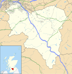
坎巴斯蘭(Cambuslang /ˈkæmbəsˈlæŋ/;低地蘇格蘭語:Cammuslang,來自蘇格蘭蓋爾語:Camas Lang)[3],或譯坎布斯朗,是蘇格蘭大格拉斯哥東南郊、南拉納克郡的一個小鎮,人口約3萬,按人口計算是蘇格蘭第27大城鎮[4]。雖然從未有過鎮政廳,但歷史上曾是一個大型民政教區,下轄附近的牛頓、弗萊明頓、韋斯特本和哈夫威等小村莊[5][6][7]。
它位於克萊德河南岸,至少從1490年當地就開始煤炭開採,此外也長期有着鋼鐵工業。蘇格蘭消防救援隊總部位於此地。
參考文獻
[編輯]- ^ Mid-2020 Population Estimates for Settlements and Localities in Scotland. National Records of Scotland. 2022-03-31 [2022-03-31] (英語).
- ^ List of UK post towns. Evox Facilities. [2012-02-22]. (原始內容存檔於19 February 2012).
- ^ Ainmean-Àite na h-Alba - Gaelic Place-Names of Scotland - Database. Gaelicplacenames.org. [2014-01-26]. (原始內容存檔於2014-02-21).
- ^ Mid-2016 Population Estimates for Settlements and Localities in Scotland. National Records of Scotland. [27 June 2019]. (原始內容存檔於2019-02-04).
- ^ The Imperial gazetteer of Scotland. 1854.
- ^ Wilson, John Marius. The Imperial gazetteer of Scotland; or, Dictionary of Scottish topography. Edinburgh A. Fullarton. 11 November 2017 [11 November 2017] –透過Internet Archive.
- ^ Parish of Cambuslang (頁面存檔備份,存於網際網路檔案館), Gazetteer for Scotland


