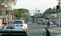
卡帕斯
外觀
此條目可參照英語維基百科相應條目來擴充。 |
| 卡帕斯 | |
|---|---|
| Municipality of Capas | |
 | |
 Map of 丹轆省 with 卡帕斯 highlighted | |
 | |
| 坐標:15°20′14″N 120°35′24″E / 15.3372°N 120.59°E | |
| 國家 | |
| 大區 | 中呂宋區 |
| 省份 | 丹轆省 |
| 描籠涯 | 20個 |
| 面積 [1] | |
| • 總計 | 376.39 平方公里(145.32 平方英里) |
| 人口(2015年) [2] | |
| • 總計 | 156,056人 |
| • 密度 | 415人/平方公里(1,074人/平方英里) |
| 時區 | PST(UTC+8) |
| 郵遞區號 | 2315 |
| PSGC | 036904000 |
| IDD:區碼 | +63 (0)45 |
| 網站 | www |
卡帕斯(他加祿語:Capas,咱人話:加巴示),是菲律賓丹轆省的一座城市。面積376.39平方公里。根據2015年人口普查結果,丹轆市擁有140,202名居民。[4]現下轄20個描籠涯。[5]
參考文獻
[編輯]- ^ Province: Tarlac. PSGC Interactive. Quezon City, Philippines: Philippine Statistics Authority. [2016-11-12].
- ^
Census of Population (2015). Total Population by Province, City, Municipality and Barangay. PSA.
|chapter=被忽略 (幫助); - ^ [https://lgu201.dilg.gov.ph/view.php?r=03&p=69&m=04 Municipality of Capas | (DILG)
- ^ Region III (Central Luzon) Census of Population (2015): Total Population by Province, City, Municipality and Barangay (Report). PSA. Makati City, Philippines: National Statistical Coordination Board. [2019-09-20]. (原始內容存檔於2019-05-09).
- ^
<references>標籤中name屬性為「nscb-area」的參考文獻沒有在文中使用15°19′39″N 120°35′27″E / 15.32750°N 120.59083°E
| 這是一篇與菲律賓相關的小作品。您可以透過編輯或修訂擴充其內容。 |

