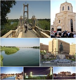
代尔祖尔
此条目可参照阿拉伯语维基百科相应条目来扩充。 |
35°20′N 40°9′E / 35.333°N 40.150°E
| 代尔祖尔 دير الزور | |
|---|---|
| 城市 | |
 | |
| 坐标:35°20′00″N 40°09′00″E / 35.3333°N 40.15°E | |
| 国家 | |
| 省 | 代尔祖尔省 |
| 区 | 代尔祖尔区 |
| 海拔 | 210 公尺(690 英尺) |
| 人口(2004年普查[1]) | |
| • 城市 | 211,857人 |
| • 都会区 | 239,196 |
| 时区 | EET(UTC+2) |
| • 夏时制 | EET(UTC+3) |
| 电话区号 | 051 |
代尔祖尔(阿拉伯语:دير الزور;阿拉米语:ܕܝܪܐ ܙܥܘܪܬܐ, 亚美尼亚语:Տէր Զօր,Դեր Զոր,Ter Zor)也译为德尔祖尔,是叙利亚东北部城市,代尔祖尔省省会。代尔祖尔地处叙利亚首都大马士革东北450公里[2],阿勒颇东南方320公里处的幼发拉底河河畔。经济以农业为主。附近古迹众多,是著名的旅游胜地[3]。
从2015年3月起,代尔祖尔被恐怖组织伊斯兰国长期围攻,[4]城内的叙政府军和20万居民倚赖空运接济。2017年9月,包围圈外的叙政府军成功打破包围,代尔祖尔之围结束。[5]
历史
[编辑]代尔祖尔在罗马时代是罗马帝国和印度之间重要的贸易驿站,在这之后它被芝诺比阿征服,受巴尔米拉统治。后续一连串的征服战争使代尔祖尔饱受战争摧残,在蒙古横扫中东时,代尔祖尔城被蒙古人摧毁了。

1867年,奥斯曼帝国重建了代尔祖尔并进行了扩建。1915年,在亚美尼亚种族大屠杀期间,这座城市成为亚美尼亚人死亡行进的主要目的地。[6] 1991年,代尔祖尔竖立起了这次事件的纪念碑。[7]
1921年,法国占领了代尔祖尔,使其成为一个大型驻军地点。与此同时,法国派一名贵族:哈吉-法德勒·阿布德(Haj-Fadel Abboud)管理该地。1941年,英国军队在叙利亚-黎巴嫩战役中击败了维希法国,其中有一场战斗就是在代尔祖尔进行的。之后他们将代尔祖尔转交给了自由法国。1946年,代尔祖尔正式成为叙利亚共和国的一部分。
自叙利亚内战爆发以来,叙利亚武装力量(政府军)和叙利亚自由军(反对派)以及其他组织(如伊斯兰国、征服沙姆阵线)之间在代尔祖尔爆发了多次武装冲突。2014年9月21日,亚美尼亚人纪念碑被伊斯兰国武装分子炸毁。据调查,他们之前是征服沙姆阵线的成员。[8][9][10]
代尔祖尔在两年多的时间里一直是叙利亚政府在叙利亚东部的少数几个军事据点之一。2015年5月,伊斯兰国武装分子发动进攻,占领了巴尔米拉,切断了通往代尔祖尔的陆上补给线。[11]伊斯兰国对代尔祖尔的围困使得代尔祖尔城的补给只能由运输直升机空投获得。[11] 伊斯兰国试图通过袭击代尔祖尔机场来阻止补给的输送。然而,他们的尝试失败了。在伊萨姆·扎赫雷丁少将领导下的叙利亚共和国卫队第104旅多次击败了来犯的武装分子。[11]
在2017年9月2日,来自苏赫奈的一支叙利亚阿拉伯军(SAA)军队到达代尔祖尔,开始进行解围行动。此后不久,伊斯兰国对代尔祖尔的围困正式解除。[12] 2017年11月3日,SAA完全解放了代尔祖尔。[13]
气候
[编辑]| 代尔祖尔 (1961–1990) | |||||||||||||
|---|---|---|---|---|---|---|---|---|---|---|---|---|---|
| 月份 | 1月 | 2月 | 3月 | 4月 | 5月 | 6月 | 7月 | 8月 | 9月 | 10月 | 11月 | 12月 | 全年 |
| 历史最高温 °C(°F) | 22.5 (72.5) |
26.1 (79.0) |
32.7 (90.9) |
40.0 (104.0) |
41.6 (106.9) |
44.2 (111.6) |
47.5 (117.5) |
47.8 (118.0) |
43.0 (109.4) |
41.0 (105.8) |
31.5 (88.7) |
23.0 (73.4) |
47.8 (118.0) |
| 平均高温 °C(°F) | 12.2 (54.0) |
15.1 (59.2) |
19.5 (67.1) |
25.4 (77.7) |
31.7 (89.1) |
36.9 (98.4) |
39.9 (103.8) |
39.3 (102.7) |
35.3 (95.5) |
28.8 (83.8) |
20.7 (69.3) |
14.0 (57.2) |
26.6 (79.9) |
| 日均气温 °C(°F) | 6.7 (44.1) |
9.1 (48.4) |
13.1 (55.6) |
18.7 (65.7) |
24.5 (76.1) |
29.6 (85.3) |
32.6 (90.7) |
31.7 (89.1) |
26.9 (80.4) |
20.9 (69.6) |
13.3 (55.9) |
8.1 (46.6) |
19.6 (67.3) |
| 平均低温 °C(°F) | 2.5 (36.5) |
3.7 (38.7) |
7.0 (44.6) |
12.0 (53.6) |
17.1 (62.8) |
21.9 (71.4) |
25.1 (77.2) |
24.5 (76.1) |
19.4 (66.9) |
13.7 (56.7) |
7.2 (45.0) |
3.2 (37.8) |
13.1 (55.6) |
| 历史最低温 °C(°F) | −7.2 (19.0) |
−8.2 (17.2) |
−3.7 (25.3) |
−2.0 (28.4) |
8.0 (46.4) |
10.6 (51.1) |
17.6 (63.7) |
16.8 (62.2) |
11.4 (52.5) |
2.5 (36.5) |
−8.0 (17.6) |
−9.3 (15.3) |
−9.3 (15.3) |
| 平均降水量 mm(英寸) | 28.1 (1.11) |
24.1 (0.95) |
27.8 (1.09) |
22.2 (0.87) |
8.6 (0.34) |
0.3 (0.01) |
0.0 (0.0) |
0.0 (0.0) |
0.2 (0.01) |
8.0 (0.31) |
12.4 (0.49) |
24.1 (0.95) |
155.8 (6.13) |
| 平均降水天数(≥ 1.0 mm) | 4.8 | 4.3 | 4.3 | 3.5 | 1.7 | 0.1 | 0.0 | 0.0 | 0.1 | 1.5 | 2.6 | 4.1 | 27.0 |
| 平均相对湿度(%) | 76 | 67 | 57 | 49 | 38 | 27 | 26 | 28 | 32 | 42 | 57 | 75 | 48 |
| 月均日照时数 | 161.2 | 179.2 | 223.2 | 243.0 | 310.0 | 351.0 | 372.0 | 356.5 | 309.0 | 257.3 | 207.0 | 161.2 | 3,130.6 |
| 日均日照时数 | 5.2 | 6.4 | 7.2 | 8.1 | 10.0 | 11.7 | 12.0 | 11.5 | 10.3 | 8.3 | 6.9 | 5.2 | 8.6 |
| 数据来源1:德国气象局[14] | |||||||||||||
| 数据来源2:NOAA[15] | |||||||||||||
参见
[编辑]参考资料
[编辑]- ^ Deir ez-Zor city population. [2016-10-05]. (原始内容存档于2012-07-31).
- ^ Syrian Ministry of Tourism (in Arabic). [2007-05-10]. (原始内容存档于2020-04-27).
- ^ 德尔祖尔. 叙利亚旅游局. [2011-08-25]. (原始内容存档于2011-11-27) (中文(简体)).
- ^ Picutres from Syria's Deir Ezzor under siege by ISIS show starving people. Daily Mail Online. 2016-01-17 [2016-10-05]. (原始内容存档于2020-11-08).
- ^ Syrian army, allies reach airbase besieged by Islamic State in eastern Syria: commander. Reuters. 2017-09-09 [2017-09-14]. (原始内容存档于2017-09-11).
- ^ Fuat Dündar. Pouring a People into the Desert:The "Definitive Solution" of the Unionists to the Armenian Question. Ronald Grigor Suny, Fatma Muge Gocek and Norman M. Naimark (Eds) (编). A Question of Genocide: Armenians and Turks at the End of the Ottoman Empire. New York: Oxford University Press. 2011: 280–281 [2017-11-04]. ISBN 978-0-19-978104-1. (原始内容存档于2020-04-27).
- ^ Monument and Memorial Complex at Der Zor, Syria. [2017-11-04]. (原始内容存档于2011-08-05).
- ^ Hayrumyan, Naira. Middle East Terror: Memory of Armenian Genocide victims targeted by ISIS militants. ArmeniaNow. 24 September 2014 [2017-11-04]. (原始内容存档于2015-09-05).
- ^ IS said to destroy Armenian Genocide memorial. 以色列时报. 22 September 2014 [2017-11-04]. (原始内容存档于2018-07-18).
- ^ Who destroyed the Armenian Genocide Martyrs’ Memorial Church in Deir Ezzor?. conflict antiquities. 12 November 2014 [20 March 2015]. (原始内容存档于2019-04-22).
- ^ 11.0 11.1 11.2 Chris Tomson. 100,000 Civilians under ISIS Siege in Eastern Syria. Al-Masdar News. 12 December 2015 [12 December 2015]. (原始内容存档于2019-03-31).
- ^ First scenes from the Syrian Army’s lifting of the Deir Ezzor siege. Al Masdar. 5 September 2017 [6 September 2017]. (原始内容存档于2020-08-03).
- ^ 存档副本. [2017-11-04]. (原始内容存档于2020-09-24).
- ^ Klimatafel von Deir Ezzor / Syrien (PDF). Baseline climate means (1961-1990) from stations all over the world. Deutscher Wetterdienst. [April 26, 2017]. (原始内容存档 (PDF)于2022-01-20) (德语).
- ^ Deir Ezzor Climate Normals 1961–1990. National Oceanic and Atmospheric Administration. [April 26, 2017].

