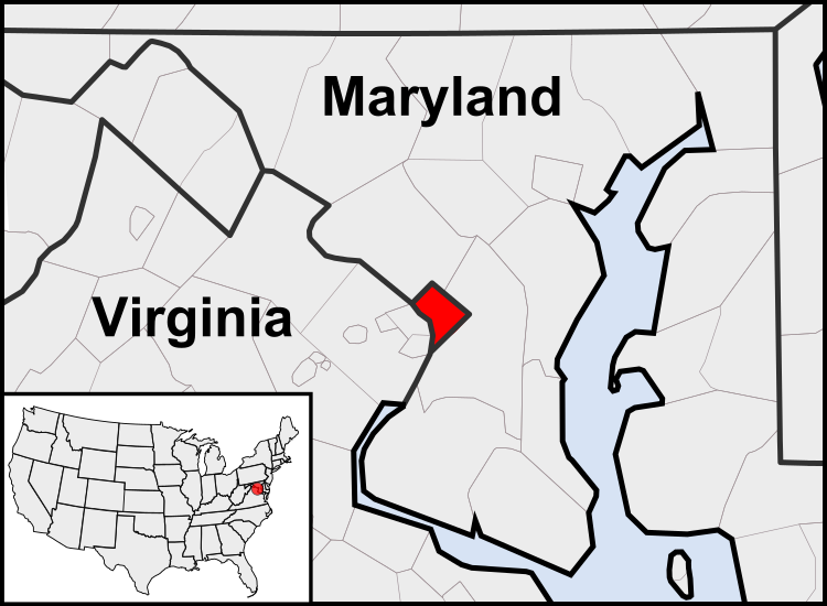
File:Washington, D.C. locator map.svg
外觀

此 SVG 檔案的 PNG 預覽的大小:750 × 550 像素。 其他解析度:320 × 235 像素 | 640 × 469 像素 | 1,024 × 751 像素 | 1,280 × 939 像素 | 2,560 × 1,877 像素。
原始檔案 (SVG 檔案,表面大小:750 × 550 像素,檔案大小:160 KB)
檔案歷史
點選日期/時間以檢視該時間的檔案版本。
| 日期/時間 | 縮圖 | 尺寸 | 使用者 | 備註 | |
|---|---|---|---|---|---|
| 目前 | 2011年7月23日 (六) 03:23 |  | 750 × 550(160 KB) | Patrickneil | Reverted to version as of 03:04, 23 July 2011 |
| 2011年7月23日 (六) 03:21 |  | 750 × 550(161 KB) | Patrickneil | Reverted to version as of 03:14, 23 July 2011 | |
| 2011年7月23日 (六) 03:20 |  | 750 × 550(161 KB) | Patrickneil | frame | |
| 2011年7月23日 (六) 03:14 |  | 750 × 550(161 KB) | Patrickneil | thicker frame | |
| 2011年7月23日 (六) 03:04 |  | 750 × 550(160 KB) | Patrickneil | straightening Maryland and Delaware borders | |
| 2010年8月15日 (日) 02:09 |  | 750 × 550(202 KB) | Patrickneil | Delaware River again | |
| 2010年8月15日 (日) 01:51 |  | 750 × 550(274 KB) | Patrickneil | Delaware River border | |
| 2010年8月15日 (日) 01:42 |  | 750 × 550(273 KB) | Patrickneil | forgot border on Smith Island | |
| 2010年8月15日 (日) 01:34 |  | 750 × 550(273 KB) | Patrickneil | county borders below state | |
| 2010年8月15日 (日) 01:32 |  | 750 × 550(274 KB) | Patrickneil | changes by request |
檔案用途
下列6個頁面有用到此檔案:
全域檔案使用狀況
以下其他 wiki 使用了這個檔案:
- af.wikipedia.org 的使用狀況
- an.wikipedia.org 的使用狀況
- ar.wikipedia.org 的使用狀況
- arz.wikipedia.org 的使用狀況
- as.wikipedia.org 的使用狀況
- azb.wikipedia.org 的使用狀況
- bh.wikipedia.org 的使用狀況
- bs.wikipedia.org 的使用狀況
- btm.wikipedia.org 的使用狀況
- ceb.wikipedia.org 的使用狀況
- ckb.wikipedia.org 的使用狀況
- en.wikipedia.org 的使用狀況
- en.wikinews.org 的使用狀況
- es.wikipedia.org 的使用狀況
- es.wiktionary.org 的使用狀況
- et.wikipedia.org 的使用狀況
- ext.wikipedia.org 的使用狀況
- fr.wikipedia.org 的使用狀況
- fr.wiktionary.org 的使用狀況
- fy.wikipedia.org 的使用狀況
- gv.wikipedia.org 的使用狀況
- hi.wikipedia.org 的使用狀況
- hu.wikipedia.org 的使用狀況
- ia.wikipedia.org 的使用狀況
- id.wikipedia.org 的使用狀況
- ilo.wikipedia.org 的使用狀況
- incubator.wikimedia.org 的使用狀況
- it.wikipedia.org 的使用狀況
- jam.wikipedia.org 的使用狀況
- ja.wikipedia.org 的使用狀況
- jbo.wikipedia.org 的使用狀況
檢視此檔案的更多全域使用狀況。

