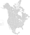
File:North America second level political division 2.svg
外觀

此 SVG 檔案的 PNG 預覽的大小:512 × 596 像素。 其他解析度:206 × 240 像素 | 412 × 480 像素 | 660 × 768 像素 | 880 × 1,024 像素 | 1,759 × 2,048 像素。
原始檔案 (SVG 檔案,表面大小:512 × 596 像素,檔案大小:132 KB)
檔案歷史
點選日期/時間以檢視該時間的檔案版本。
| 日期/時間 | 縮圖 | 尺寸 | 使用者 | 備註 | |
|---|---|---|---|---|---|
| 目前 | 2020年11月23日 (一) 01:51 |  | 512 × 596(132 KB) | Ponderosapine210 | Added the prominent islands of Manitoulin (Ontario) and Isle Royale (Michigan) to the Great Lakes. |
| 2019年6月1日 (六) 23:07 |  | 512 × 596(130 KB) | Fluffy89502 | added territories, made DC visible, adjusted mexican borders | |
| 2014年4月4日 (五) 12:23 |  | 1,712 × 1,992(270 KB) | Lommes | made the borders between the mexican subdivisions the same size as their canadian / us counterparts. | |
| 2007年12月8日 (六) 23:23 |  | 1,712 × 1,992(327 KB) | Lokal Profil | Code cleanup | |
| 2007年10月7日 (日) 07:55 |  | 1,712 × 1,992(342 KB) | AlexCovarrubias | == Summary == {{Information |Description=Map of North America and its second-level political divisions. Canadian provinces, US and Mexican states. Canada, Mexico, United States. |Source=Canada and US map by Alan Rockefeller. Mexico map by Alex Covarrubias |
檔案用途
沒有使用此檔案的頁面。
全域檔案使用狀況
以下其他 wiki 使用了這個檔案:
- en.wikipedia.org 的使用狀況
- sk.wikipedia.org 的使用狀況

