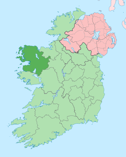
File:Island of Ireland location map Mayo.svg
外觀

此 SVG 檔案的 PNG 預覽的大小:481 × 599 像素。 其他解析度:192 × 240 像素 | 385 × 480 像素 | 616 × 768 像素 | 822 × 1,024 像素 | 1,643 × 2,048 像素 | 1,450 × 1,807 像素。
原始檔案 (SVG 檔案,表面大小:1,450 × 1,807 像素,檔案大小:642 KB)
檔案歷史
點選日期/時間以檢視該時間的檔案版本。
| 日期/時間 | 縮圖 | 尺寸 | 使用者 | 備註 | |
|---|---|---|---|---|---|
| 目前 | 2020年6月28日 (日) 14:01 |  | 1,450 × 1,807(642 KB) | Chipmunkdavis | Per the Local Government Reform Act 2014, joining both Tipperarys and both Waterfords (and removing Limerick City code). Colouring in islands, cleaning up and grouping code to remove stray objects and show Galway and Lough Ree. |
| 2010年7月19日 (一) 00:58 |  | 1,450 × 1,807(815 KB) | Mabuska | {{Information |Description={{en|The island of Ireland, showing international border between Northern Ireland and Republic of Ireland, traditional provinces, traditional counties, and local authority areas in the Republic of Ireland and Northern Ireland.}} |
檔案用途
下列頁面有用到此檔案:
全域檔案使用狀況
以下其他 wiki 使用了這個檔案:
- ang.wikipedia.org 的使用狀況
- ar.wikipedia.org 的使用狀況
- arz.wikipedia.org 的使用狀況
- ast.wikipedia.org 的使用狀況
- bg.wikipedia.org 的使用狀況
- ca.wikipedia.org 的使用狀況
- Comtat de Mayo
- Castlebar
- Cong
- Plantilla:Comtat Mayo
- Ballina
- Westport (Mayo)
- Gob an Choire
- Eachléim
- Béal Deirg
- Bun an Churraigh
- Dún Ibhir
- Dumha Éige
- An Caiseal
- Sáile
- Tuar Mhic Éadaigh
- Béal an Mhuirthead
- Ceathrú Thaidhg
- Gleann an Ghad
- Ros Dumhach
- Iorras
- Illa de Clare
- Doohoma
- Gweesalia
- Bangor Erris
- Crossmolina
- Killala
- Kilcummin
- Turlough
- ceb.wikipedia.org 的使用狀況
- cs.wikipedia.org 的使用狀況
- de.wikivoyage.org 的使用狀況
- en.wikipedia.org 的使用狀況
檢視此檔案的更多全域使用狀況。

