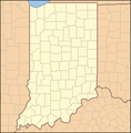
File:Indiana Locator Map.PNG
外觀
Indiana_Locator_Map.PNG (288 × 293 像素,檔案大小:10 KB,MIME 類型:image/png)
檔案歷史
點選日期/時間以檢視該時間的檔案版本。
| 日期/時間 | 縮圖 | 尺寸 | 使用者 | 備註 | |
|---|---|---|---|---|---|
| 目前 | 2007年4月25日 (三) 03:57 |  | 288 × 293(10 KB) | Ruhrfisch | == Summary == {{Information| |Description= Locator Map of Indiana, United States |Source= taken from US Census website [http://factfinder.census.gov/] and modified by User:Ruhrfisch |Date= April 2007 |Author= US Census, Ruhrfisch |Permission= US Cens |
| 2007年4月2日 (一) 01:08 |  | 288 × 293(10 KB) | Ruhrfisch | {{Information| |Description= Locator Map of Indiana, United States |Source= taken from US Census website [http://factfinder.census.gov/] and modified by User:Ruhrfisch |Date= April 2007 |Author= US Census, Ruhrfisch |Permission= US Census / US Govern |
檔案用途
下列9個頁面有用到此檔案:
全域檔案使用狀況
以下其他 wiki 使用了這個檔案:
- ceb.wikipedia.org 的使用狀況
- de.wikipedia.org 的使用狀況
- en.wikipedia.org 的使用狀況
- fa.wikipedia.org 的使用狀況
- hu.wiktionary.org 的使用狀況


