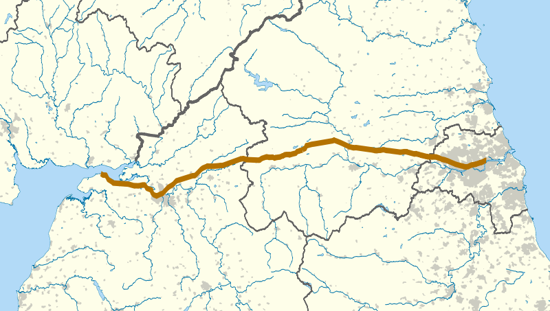
File:Hadrian's Wall map.svg
外觀

此 SVG 檔案的 PNG 預覽的大小:800 × 453 像素。 其他解析度:320 × 181 像素 | 640 × 362 像素 | 1,024 × 579 像素 | 1,280 × 724 像素 | 2,560 × 1,449 像素 | 1,267 × 717 像素。
原始檔案 (SVG 檔案,表面大小:1,267 × 717 像素,檔案大小:1.12 MB)
檔案歷史
點選日期/時間以檢視該時間的檔案版本。
| 日期/時間 | 縮圖 | 尺寸 | 使用者 | 備註 | |
|---|---|---|---|---|---|
| 目前 | 2010年9月22日 (三) 22:06 |  | 1,267 × 717(1.12 MB) | Nilfanion | darker urban area, wall thicker |
| 2010年9月22日 (三) 22:00 |  | 1,267 × 717(1.12 MB) | Nilfanion | {{Information |Description=The route of Hadrian's Wall (in brown) in northern England. The background map shows modern counties and urban areas. Equirectangular map projection on WGS 84 datum, with N/S stretched 170% Geographic lim |
檔案用途
下列頁面有用到此檔案:
全域檔案使用狀況
以下其他 wiki 使用了這個檔案:
- af.wikipedia.org 的使用狀況
- en.wikipedia.org 的使用狀況
- es.wikipedia.org 的使用狀況
- it.wikipedia.org 的使用狀況
- ko.wikipedia.org 的使用狀況
- lv.wikipedia.org 的使用狀況
- mk.wikipedia.org 的使用狀況
- ms.wikipedia.org 的使用狀況
- pt.wikipedia.org 的使用狀況
- ro.wikipedia.org 的使用狀況
- sl.wikipedia.org 的使用狀況

