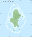
File:Futuna location map.svg
外觀

此 SVG 檔案的 PNG 預覽的大小:800 × 551 像素。 其他解析度:320 × 220 像素 | 640 × 441 像素 | 1,024 × 705 像素 | 1,280 × 881 像素 | 2,560 × 1,762 像素 | 969 × 667 像素。
原始檔案 (SVG 檔案,表面大小:969 × 667 像素,檔案大小:50 KB)
檔案歷史
點選日期/時間以檢視該時間的檔案版本。
| 日期/時間 | 縮圖 | 尺寸 | 使用者 | 備註 | |
|---|---|---|---|---|---|
| 目前 | 2010年7月12日 (一) 18:14 |  | 969 × 667(50 KB) | Sting | == {{int:filedesc}} == {{Location|14|18|00|S|178|05|15|W|scale:100000}} <br/> {{Information |Description={{en|Blank administrative map of Hoorn Islands (Futuna and Alofi Islands), part of the [[:en:French overseas collectivity|French |
檔案用途
下列6個頁面有用到此檔案:
全域檔案使用狀況
以下其他 wiki 使用了這個檔案:
- ar.wikipedia.org 的使用狀況
- bn.wikipedia.org 的使用狀況
- bs.wikipedia.org 的使用狀況
- ceb.wikipedia.org 的使用狀況
- de.wikipedia.org 的使用狀況
- Wikipedia:Kartenwerkstatt/Positionskarten/Australien und Ozeanien
- Vorlage:Positionskarte Horn-Inseln
- Alofitai
- Malaʻe (Alo)
- Ono (Wallis und Futuna)
- Taoa (Futuna)
- Kolia
- Vele
- Poi (Wallis und Futuna)
- Tamana (Wallis und Futuna)
- Tuatafa
- Fiua
- Flughafen Futuna Pointe Vele
- Leava
- Nuku (Sigave)
- Tavai (Wallis und Futuna)
- Toloke
- Vaisei
- el.wikipedia.org 的使用狀況
- en.wikipedia.org 的使用狀況
- Pointe Vele Airport
- Mala'e (Futuna)
- Leava
- Module:Location map/data/Futuna/doc
- Kolia, Wallis and Futuna
- Ono, Wallis and Futuna
- Poi, Wallis and Futuna
- Tamana, Wallis and Futuna
- Taoa
- Tuatafa
- Vele, Wallis and Futuna
- Toloke
- Tavai, Wallis and Futuna
- Fiua
- Vaisei
- Alofitai
- Nuku, Wallis and Futuna
- Module:Location map/data/Futuna
- eo.wikipedia.org 的使用狀況
- fa.wikipedia.org 的使用狀況
- fr.wikipedia.org 的使用狀況
檢視此檔案的更多全域使用狀況。


