跳转到内容

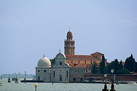
File:Chiesa di S.Michele in Isola, north exposure.jpg

页面内容不支持其他语言。
这个文件来自维基共享资源
维基百科,自由的百科全书

原始文件 (7,429 × 4,680像素,文件大小:19.78 MB,MIME类型:image/jpeg


摘要

San Michele in Isola in, Venice, north exposure.

VI seal

根据最有价值图像标准,这张图像被评定为在San Michele in Isola in, Venice, north exposure.范畴内最有价值的共享资源图像。你可以在Commons:Valued image candidates/Chiesa di S.Michele in Isola, north exposure.jpg参看它的提名。

描述
English: San Michele in Isola in Venice. First building renaissance of the lagoon it is due to the architect Mauro Codussi. On the right side of the facade the Cappella Emiliana' 'hexagonal surmounted by a cupola, was built by Guglielmo dei Grigi says Guglielmo Bergamasco between 1528 and 1543.
Français : Église San Michele in Isola à Venise. Premier édifice renaissance de la lagune elle est due à l'architecte Mauro Codussi. Sur le côté droit de la façade la Cappella Emiliana, de forme hexagonale surmontée d'une coupole, a été construite par Guglielmo dei Grigi, dit Guglielmo Bergamasco entre 1528 et 1543.
Italiano: Chiesa di San Michele in Isola Venezia. Primo edificio rinascimentale della laguna è dovuta all'architetto Mauro Codussi. Sul lato destro della facciata della Cappella Emiliana esagonale sormontato da una cupola, è stato costruito da Guglielmo dei Grigi dice Guglielmo Bergamasco tra il 1528 e il 1543.
日期 摄于2015年5月10日
来源 自己的作品
作者 Didier Descouens
授权
(二次使用本文件)
This file is copyrighted and has been released under a license which is incompatible with Facebook's licensing terms. It is not permitted to upload this file at Facebook.
我,本作品著作权人,特此采用以下许可协议发表本作品:
w:zh:知识共享
署名 相同方式共享
本文件采用知识共享署名-相同方式共享 4.0 国际许可协议授权。
您可以自由地:
  • 共享 – 复制、发行并传播本作品
  • 修改 – 改编作品
惟须遵守下列条件:
  • 署名 – 您必须对作品进行署名,提供授权条款的链接,并说明是否对原始内容进行了更改。您可以用任何合理的方式来署名,但不得以任何方式表明许可人认可您或您的使用。
  • 相同方式共享 – 如果您再混合、转换或者基于本作品进行创作,您必须以与原先许可协议相同或相兼容的许可协议分发您贡献的作品。
其他版本
物体位置45° 26′ 56.09″ 北, 12° 20′ 48.96″ 东 Kartographer map based on OpenStreetMap.在以下服务上查看本图像和附近其他图像: OpenStreetMapinfo
相机位置45° 27′ 00.88″ 北, 12° 20′ 47.74″ 东 Kartographer map based on OpenStreetMap.在以下服务上查看本图像和附近其他图像: OpenStreetMapinfo
注解
InfoField
该图片含有注解:在维基媒体共享资源上查看注解

说明

添加一行文字以描述该文件所表现的内容

此文件中描述的项目

描绘内容

创作作者 简体中文(已转写)

某些值没有维基数据项目

作者姓名字符串 简体中文(已转写):​Didier Descouens
维基媒体用户名 简体中文(已转写):​Archaeodontosaurus
客体角色 简体中文(已转写):​摄影师 简体中文(已转写)

版权状态 简体中文(已转写)

版权所有 简体中文(已转写)

视角坐标 简体中文(已转写)

45°27'0.882"N, 12°20'47.742"E

文件来源 简体中文(已转写)

上传者的原创作品 简体中文(已转写)

共享资源质量评价 简体中文(已转写)

维基共享资源最有价值图像 简体中文(已转写)

始于:​30 9 2015

摄影器材 简体中文(已转写)

尼康D800E 中文(已转写)

描述地坐标 中文(已转写)

45°26'56.090"N, 12°20'48.955"E

曝光时间 简体中文(已转写)

0.002

焦距比数 简体中文(已转写)

8

焦距 简体中文(已转写)

50 毫米

ISO速度 简体中文(已转写)

100

媒体类型 简体中文(已转写)

image/jpeg

校验和 简体中文(已转写)

a1bef07aa7970054bb08b793ed81a8d0923fe883

断定方法:​SHA-1 简体中文(已转写)

数据大小 简体中文(已转写)

20,740,091 字节

4,680 像素

7,429 像素

文件历史

点击某个日期/时间查看对应时刻的文件。

日期/时间缩⁠略⁠图大小用户备注
当前2015年7月28日 (二) 06:272015年7月28日 (二) 06:27版本的缩略图7,429 × 4,680(19.78 MB)Archaeodontosaurus{{Information |Description ={{en|1=c}} |Source ={{own}} |Author =Archaeodontosaurus |Date = |Permission = |other_versions = }}

以下2个页面使用本文件:

全域文件用途

以下其他wiki使用此文件:

元数据