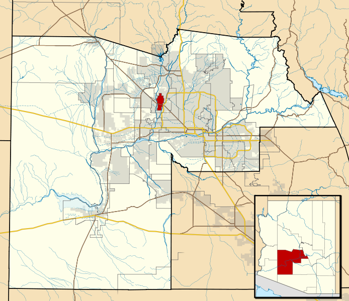
File:Maricopa County Incorporated and Planning areas Sun City highlighted.svg
外观

此SVG文件的PNG预览的大小:694 × 599像素。 其他分辨率:278 × 240像素 | 556 × 480像素 | 889 × 768像素 | 1,185 × 1,024像素 | 2,371 × 2,048像素 | 940 × 812像素。
原始文件 (SVG文件,尺寸为940 × 812像素,文件大小:1.05 MB)
文件历史
点击某个日期/时间查看对应时刻的文件。
| 日期/时间 | 缩略图 | 大小 | 用户 | 备注 | |
|---|---|---|---|---|---|
| 当前 | 2011年5月20日 (五) 06:44 |  | 940 × 812(1.05 MB) | Ixnayonthetimmay | Uploading new version |
| 2008年8月30日 (六) 04:43 |  | 900 × 800(413 KB) | Ixnayonthetimmay | == Summary == {{Information |Description=This map shows the incorporated areas and unincorporated areas in Maricopa County, Arizona. [[:en:Sentinel, Arizona| | |
| 2007年9月15日 (六) 23:43 |  | 900 × 800(385 KB) | Ixnayonthetimmay | {{Information |Description= |Source= |Date= |Author= |Permission= |other_versions= }} | |
| 2007年5月28日 (一) 10:14 |  | 900 × 780(330 KB) | Ixnayonthetimmay | ||
| 2007年5月22日 (二) 01:20 |  | 900 × 780(322 KB) | Ixnayonthetimmay | ||
| 2007年1月30日 (二) 05:26 |  | 904 × 758(178 KB) | Ixnayonthetimmay | {{Information |Description=This map shows the incorporated areas in Maricopa County, Arizona, highlighting Sun City in red. It also shows the boundaries for the |
文件用途
以下页面使用本文件:
全域文件用途
以下其他wiki使用此文件:
- ar.wikipedia.org上的用途
- arz.wikipedia.org上的用途
- azb.wikipedia.org上的用途
- ca.wikipedia.org上的用途
- ceb.wikipedia.org上的用途
- de.wikipedia.org上的用途
- eu.wikipedia.org上的用途
- fa.wikipedia.org上的用途
- fr.wikipedia.org上的用途
- glk.wikipedia.org上的用途
- ht.wikipedia.org上的用途
- it.wikipedia.org上的用途
- ja.wikipedia.org上的用途
- simple.wikipedia.org上的用途
- sr.wikipedia.org上的用途
- tt.wikipedia.org上的用途
- vo.wikipedia.org上的用途
- www.wikidata.org上的用途
- zh-min-nan.wikipedia.org上的用途

