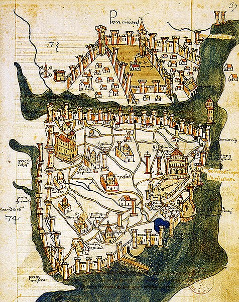
File:Map of Constantinople (1422) by Florentine cartographer Cristoforo Buondelmonte.jpg
外观

本预览的尺寸:476 × 600像素。 其他分辨率:190 × 240像素 | 592 × 746像素。
原始文件 (592 × 746像素,文件大小:838 KB,MIME类型:image/jpeg)
文件历史
点击某个日期/时间查看对应时刻的文件。
| 日期/时间 | 缩略图 | 大小 | 用户 | 备注 | |
|---|---|---|---|---|---|
| 当前 | 2007年6月25日 (一) 10:24 |  | 592 × 746(838 KB) | M.K. | {{Information |Description=Map of Constantinople (1422) by Florentine cartographer Cristoforo Buondelmonte (''Description des îles de l'archipel'', Bibliothèque nationale, Paris) is the oldest surviving map of the city, and the only surviving ma |
文件用途
以下6个页面使用本文件:
全域文件用途
以下其他wiki使用此文件:
- ar.wikipedia.org上的用途
- az.wikipedia.org上的用途
- ba.wikipedia.org上的用途
- bg.wikipedia.org上的用途
- ca.wikipedia.org上的用途
- cs.wikipedia.org上的用途
- de.wikipedia.org上的用途
- el.wikipedia.org上的用途
- en.wikipedia.org上的用途
- Bosporus
- Constantinople
- Constantine XI Palaiologos
- John VII Palaiologos
- Walls of Constantinople
- Beyoğlu
- Maiden's Tower
- Siege of Constantinople (1422)
- Siege of Constantinople (1411)
- Template:Did you know nominations/Kontoskalion
- Piyalepaşa, Beyoğlu
- Wikipedia:Main Page history/2019 February 23
- Siege of Constantinople (1394–1402)
- es.wikipedia.org上的用途
- et.wikipedia.org上的用途
- eu.wikipedia.org上的用途
- fa.wikipedia.org上的用途
- frp.wikipedia.org上的用途
- fr.wikipedia.org上的用途
查看此文件的更多全域用途。


