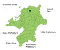
File:Nakama in Fukuoka Prefecture.png
外觀

預覽大小:719 × 599 像素。 其他解析度:288 × 240 像素 | 576 × 480 像素 | 922 × 768 像素 | 1,081 × 901 像素。
原始檔案 (1,081 × 901 像素,檔案大小:42 KB,MIME 類型:image/png)
檔案歷史
點選日期/時間以檢視該時間的檔案版本。
| 日期/時間 | 縮圖 | 尺寸 | 用戶 | 備註 | |
|---|---|---|---|---|---|
| 目前 | 2010年2月5日 (五) 14:32 |  | 1,081 × 901(42 KB) | Alberth2 | Kurogi Town, Tachibana Town, Hoshino Village, and Yabe Village were merged into Yame City. |
| 2010年1月16日 (六) 09:10 |  | 1,081 × 901(42 KB) | Alberth2 | Maebaru city, Shima town and Nijo town were merged to Itoshima City. | |
| 2009年5月12日 (二) 05:57 |  | 1,081 × 901(42 KB) | Alberth2 | == Summary == {{Information |Description=Location Map of Nakama in Fukuoka Prefecture, Japan |Source=File:FukuokaMapCurrent.png and rework |Date=May. 12th, 2009 |Author=user:alberth2 |Permission=PD |other_versions= }} == Licensing == {{PD-self}} |
檔案用途
下列頁面有用到此檔案:

