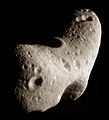
File:Eros - PIA02923 (color).jpg
外觀

預覽大小:544 × 600 像素。 其他解析度:218 × 240 像素 | 435 × 480 像素 | 760 × 838 像素。
原始檔案 (760 × 838 像素,檔案大小:170 KB,MIME 類型:image/jpeg)
檔案歷史
點選日期/時間以檢視該時間的檔案版本。
| 日期/時間 | 縮圖 | 尺寸 | 用戶 | 備註 | |
|---|---|---|---|---|---|
| 目前 | 2015年12月31日 (四) 07:16 |  | 760 × 838(170 KB) | PlanetUser | == {{int:filedesc}} == {{Information |Description={{en|While NEAR Shoemaker orbits Eros, the asteroid appears too large for the camera's field of view. In order to get a complete view of the surface from a particular vantage point, several images are m... |
檔案用途
下列6個頁面有用到此檔案:
全域檔案使用狀況
以下其他 wiki 使用了這個檔案:
- anp.wikipedia.org 的使用狀況
- ar.wikipedia.org 的使用狀況
- az.wikipedia.org 的使用狀況
- bh.wikipedia.org 的使用狀況
- bs.wikipedia.org 的使用狀況
- ca.wikipedia.org 的使用狀況
- cs.wikipedia.org 的使用狀況
- de.wikipedia.org 的使用狀況
- el.wikipedia.org 的使用狀況
- en.wikipedia.org 的使用狀況
- Asteroid
- Near-Earth object
- 2001
- 433 Eros
- NEAR Shoemaker
- Talk:2001
- S-type asteroid
- List of Solar System objects by size
- William Stephen Finsen
- NASA
- Discovery and exploration of the Solar System
- User:Fotaun
- List of minor planets and comets visited by spacecraft
- User:PlanetUser
- List of craters on minor planets
- User:Marginataen/sandbox
- User:Bennett1203/sandbox
- en.wikiversity.org 的使用狀況
- es.wikipedia.org 的使用狀況
- eu.wikipedia.org 的使用狀況
- fa.wikipedia.org 的使用狀況
- fr.wikipedia.org 的使用狀況
- hr.wikipedia.org 的使用狀況
- ie.wikipedia.org 的使用狀況
- it.wikipedia.org 的使用狀況
- ja.wikipedia.org 的使用狀況
- kk.wikipedia.org 的使用狀況
- ko.wikipedia.org 的使用狀況
- kv.wikipedia.org 的使用狀況
- lij.wikipedia.org 的使用狀況
- mk.wikipedia.org 的使用狀況
- ml.wikipedia.org 的使用狀況
- ms.wikipedia.org 的使用狀況
- nds.wikipedia.org 的使用狀況
- om.wikipedia.org 的使用狀況
檢視此檔案的更多全域使用狀況。


