跳至內容

File:BlankMap-USA-states-Canada-provinces, HI closer.svg

頁面內容不支援其他語言。
這個檔案來自維基共享資源
維基百科,自由的百科全書

原始檔案 (SVG 檔案,表面大小:512 × 512 像素,檔案大小:104 KB)


描述
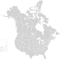
English: Blank SVG map of USA and Canada with state and province borders. Hawaii has been moved closer to the mainland USA to reduce width of image.

Non-contiguous parts of a states/provinces are "grouped" together with the main area of the state/provinces, so any state/provinces can be coloured in completion with one click anywhere on the state/provinces's area.

Also, all states/provinces have a "id" attached to them, making them easy to find. Select "find" and then enter in the state/provinces's ISO 3166-2 code in the "id" field to find it. The codes can be found here (Canada) and here (USA).
日期
來源
 
SVG檔案的原始碼通過W3C驗證
 
向量圖形使用Inkscape創作,並進行了手工編輯
作者 Lokal_Profil
授權許可
(重用此檔案)
w:zh:共享創意
姓名標示 相同方式分享
姓名標示: Lokal_Profil
您可以自由:
  • 分享 – 複製、發佈和傳播本作品
  • 重新修改 – 創作演繹作品
惟需遵照下列條件:
  • 姓名標示 – 您必須指名出正確的製作者,和提供授權條款的連結,以及表示是否有對內容上做出變更。您可以用任何合理的方式來行動,但不得以任何方式表明授權條款是對您許可或是由您所使用。
  • 相同方式分享 – 若要根據本素材進行再混合、轉換或創作,則必須以與原作相同或相容的授權來發布您的作品。
其他版本
 
向量圖片包含有元素提取或採用自:​
BlankMap-USA-states-Canada-provinces.svg.

Derivative works of this file:

The same as this map with the two-letter state or province name label for each one
Original with Hawaii at the natural distance
Original map with labels
Map including Mexico File:Painted Turtle Distribution.svg

File:Manhattan Project US Canada Map.svg

說明

添加單行說明來描述出檔案所代表的內容

在此檔案描寫的項目

描繪內容

著作權狀態 繁體中文 (已轉換拼寫)

有著作權 繁體中文 (已轉換拼寫)

多媒體型式 繁體中文 (已轉換拼寫)

image/svg+xml

校驗和 繁體中文 (已轉換拼寫)

1a53486c7abe46a1c732a515010b2062cbc773ed

斷定方法:​SHA-1 中文 (已轉換拼寫)

106,027 位元組

512 像素

512 像素

檔案歷史

點選日期/時間以檢視該時間的檔案版本。

日期/時間縮⁠圖尺寸用戶備⁠註
目前2020年11月23日 (一) 01:48於 2020年11月23日 (一) 01:48 版本的縮圖512 × 512(104 KB)Ponderosapine210Accidentally uploaded wrong version. Here is the correct one.
2020年11月23日 (一) 01:38於 2020年11月23日 (一) 01:38 版本的縮圖512 × 596(132 KB)Ponderosapine210Added the prominent islands of Manitoulin (Ontario) and Isle Royale (Michigan) to the Great Lakes.
2019年6月1日 (六) 22:59於 2019年6月1日 (六) 22:59 版本的縮圖512 × 512(99 KB)Fluffy89502added territories
2007年12月8日 (六) 21:18於 2007年12月8日 (六) 21:18 版本的縮圖1,730 × 1,730(212 KB)Lokal ProfilCode trimming
2007年7月3日 (二) 04:21於 2007年7月3日 (二) 04:21 版本的縮圖1,730 × 1,730(213 KB)Lokal Profil{{Information |Description={{en|Blank SVG map of USA and Canada with state and province borders. Hawaii has been moved closer to the mainland USA to reduce width of image.}} Non-contiguous parts of a states/provinces are "grouped" together with the main a

沒有使用此檔案的頁面。

全域檔案使用狀況

以下其他 wiki 使用了這個檔案:

詮釋資料