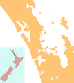
File:NZ-Auckland plain map.png
外觀
NZ-Auckland_plain_map.png (378 × 423 像素,檔案大小:28 KB,MIME 類型:image/png)
檔案歷史
點選日期/時間以檢視該時間的檔案版本。
| 日期/時間 | 縮圖 | 尺寸 | 使用者 | 備註 | |
|---|---|---|---|---|---|
| 目前 | 2008年8月25日 (一) 08:45 |  | 378 × 423(28 KB) | Grutness | == Summary == {{Information |Description=Locator map for Marlborough, New Zealand |Source=combination of Image:NZ-NI plain map.png and Image:Position_of_Auckland_Region.png |Date=25 August 2008 |Author=Grutness |Permission=public domain |other_v |
檔案用途
下列3個頁面有用到此檔案:
全域檔案使用狀況
以下其他 wiki 使用了這個檔案:
- ang.wikipedia.org 的使用狀況
- an.wikipedia.org 的使用狀況
- ar.wikipedia.org 的使用狀況
- ceb.wikipedia.org 的使用狀況
- en.wikipedia.org 的使用狀況
- Auckland Airport
- Rodney District
- Warkworth, New Zealand
- Jellicoe Channel
- Cradock Channel
- Hunua Ranges
- Kawau Island
- Great Barrier Aerodrome
- Motukorea
- Pākiri
- Auckland CBD
- Lower Nihotupu Reservoir
- Waitākere Reservoir
- User:Esradekan/Sandbox/Music
- Ōmana Regional Park
- Module:Location map/data/New Zealand Auckland/doc
- Woodhill, Auckland
- Long Bay Regional Park
- Lake Wainamu
- Cosseys Reservoir
- Lake Kawaupaka
- Shakespear Regional Park
- Lake Rototoa
- Lake Keretā
- Lake Kuwakatai
- Wenderholm Regional Park
- User:Rawirig/sandbox
- Coxs Bay
- Waitawa Regional Park
- Upper Nihotupu Reservoir
- Okiwi Airfield
- Module:Location map/data/New Zealand Auckland
- Muriwai Regional Park
- Ambury Regional Park
- Ātiu Creek Regional Park
- Glenfern Sanctuary Regional Park
- Orere Point Regional Park
- Pākiri Regional Park
- Whakatīwai Regional Park
- Tāpapakanga Regional Park
- Tāwharanui Regional Park
- Tawhitokino Regional Park
- Te Ārai Regional Park
- Waharau Regional Park
檢視此檔案的更多全域使用狀況。


