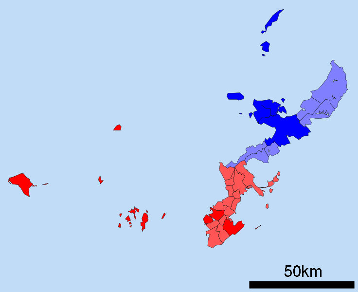
File:Boundaries of the Okinawan Languages.svg
外觀

此 SVG 檔案的 PNG 預覽的大小:736 × 600 像素。 其他解析度:295 × 240 像素 | 589 × 480 像素 | 942 × 768 像素 | 1,257 × 1,024 像素 | 2,513 × 2,048 像素。
原始檔案 (SVG 檔案,表面大小:800 × 652 像素,檔案大小:21 KB)
檔案歷史
點選日期/時間以檢視該時間的檔案版本。
| 日期/時間 | 縮圖 | 尺寸 | 使用者 | 備註 | |
|---|---|---|---|---|---|
| 目前 | 2010年12月25日 (六) 00:49 |  | 800 × 652(21 KB) | Io Katai | fixed links |
| 2010年12月25日 (六) 00:47 |  | 800 × 652(21 KB) | Io Katai | Missed out on a few links | |
| 2010年12月25日 (六) 00:41 |  | 800 × 652(21 KB) | Io Katai | {{Information |Description=A map of the Okinawan Islands displaying the distribution of the Northern Okinawan Language (Kunigami) in blue, and the South-Central Okinawan Language (Shuri-Naha) in red. The darker areas represent regions that have been offic |
檔案用途
全域檔案使用狀況
以下其他 wiki 使用了這個檔案:
- ast.wikipedia.org 的使用狀況
- ca.wikipedia.org 的使用狀況
- cdo.wikipedia.org 的使用狀況
- cs.wikipedia.org 的使用狀況
- en.wikipedia.org 的使用狀況
- et.wikipedia.org 的使用狀況
- fa.wikipedia.org 的使用狀況
- fi.wikipedia.org 的使用狀況
- fr.wikipedia.org 的使用狀況
- gd.wikipedia.org 的使用狀況
- gl.wikipedia.org 的使用狀況
- gn.wikipedia.org 的使用狀況
- haw.wikipedia.org 的使用狀況
- hu.wikipedia.org 的使用狀況
- iba.wikipedia.org 的使用狀況
- id.wikipedia.org 的使用狀況
- incubator.wikimedia.org 的使用狀況
- it.wikipedia.org 的使用狀況
- ja.wikipedia.org 的使用狀況
- kge.wikipedia.org 的使用狀況
- ko.wikipedia.org 的使用狀況
- ms.wikipedia.org 的使用狀況
- pt.wikipedia.org 的使用狀況
- ru.wikipedia.org 的使用狀況
- sc.wikipedia.org 的使用狀況
- simple.wikipedia.org 的使用狀況
- si.wikipedia.org 的使用狀況
- sr.wikipedia.org 的使用狀況
- sv.wikipedia.org 的使用狀況
- th.wikipedia.org 的使用狀況
- tr.wikipedia.org 的使用狀況
- uk.wikipedia.org 的使用狀況
- vi.wikipedia.org 的使用狀況
- zh-min-nan.wikipedia.org 的使用狀況


