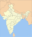
File:India district map (de-facto).svg
外观

此SVG文件的PNG预览的大小:557 × 600像素。 其他分辨率:223 × 240像素 | 446 × 480像素 | 713 × 768像素 | 951 × 1,024像素 | 1,902 × 2,048像素 | 1,500 × 1,615像素。
原始文件 (SVG文件,尺寸为1,500 × 1,615像素,文件大小:3.1 MB)
文件历史
点击某个日期/时间查看对应时刻的文件。
| 日期/时间 | 缩略图 | 大小 | 用户 | 备注 | |
|---|---|---|---|---|---|
| 当前 | 2022年5月2日 (一) 05:18 |  | 1,500 × 1,615(3.1 MB) | C1MM | Updated to 2022 |
| 2022年2月6日 (日) 16:46 |  | 1,643 × 1,856(1.88 MB) | Milenioscuro | standard colors | |
| 2021年9月22日 (三) 04:34 |  | 1,643 × 1,856(1.88 MB) | C1MM | Removed duplicate districts | |
| 2021年9月22日 (三) 04:09 |  | 1,643 × 1,856(1.89 MB) | C1MM | Added far more accurate district boundaries | |
| 2021年2月16日 (二) 20:23 |  | 1,643 × 1,856(2 MB) | C1MM | Added better district boundaries | |
| 2020年11月13日 (五) 06:00 |  | 1,643 × 1,856(1.9 MB) | C1MM | Updated shapefiles, made district boundaries more accurate | |
| 2020年7月25日 (六) 21:00 |  | 1,643 × 1,856(1.65 MB) | C1MM | Fixed state and intl border colours | |
| 2020年7月25日 (六) 05:00 |  | 1,643 × 1,856(1.64 MB) | C1MM | Reformatted for easier use, updated district map to situation as of July 2020 | |
| 2017年3月15日 (三) 20:34 |  | 1,643 × 1,856(800 KB) | Superbenjamin | User created page with UploadWizard |
文件用途
以下页面使用本文件:
全域文件用途
以下其他wiki使用此文件:
- anp.wikipedia.org上的用途
- arz.wikipedia.org上的用途
- bh.wikipedia.org上的用途
- bn.wikipedia.org上的用途
- de.wikipedia.org上的用途
- en.wikipedia.org上的用途
- es.wikipedia.org上的用途
- fa.wikipedia.org上的用途
- fr.wikipedia.org上的用途
- hif.wikipedia.org上的用途
- it.wikipedia.org上的用途
- ko.wikipedia.org上的用途
- mai.wikipedia.org上的用途
- ne.wikipedia.org上的用途
- nl.wikipedia.org上的用途
- pnb.wikipedia.org上的用途
- sat.wikipedia.org上的用途
- simple.wikipedia.org上的用途
- ta.wikipedia.org上的用途
- tcy.wikipedia.org上的用途
- th.wikipedia.org上的用途
- tr.wikipedia.org上的用途
- tum.wikipedia.org上的用途
- uk.wikipedia.org上的用途
- ur.wikipedia.org上的用途
- vi.wikipedia.org上的用途

