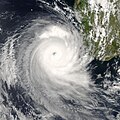
File:Favio 2007-02-20 1115Z.jpg
外观

本预览的尺寸:471 × 599像素。 其他分辨率:188 × 240像素 | 377 × 480像素 | 603 × 768像素 | 804 × 1,024像素 | 1,609 × 2,048像素 | 4,400 × 5,600像素。
原始文件 (4,400 × 5,600像素,文件大小:4.35 MB,MIME类型:image/jpeg)
文件历史
点击某个日期/时间查看对应时刻的文件。
| 日期/时间 | 缩略图 | 大小 | 用户 | 备注 | |
|---|---|---|---|---|---|
| 当前 | 2007年9月7日 (五) 20:58 |  | 4,400 × 5,600(4.35 MB) | Good kitty | Reverted to version as of 22:40, 20 February 2007 |
| 2007年2月23日 (五) 13:46 |  | 3,400 × 3,399(1.96 MB) | NSLE-Chacor | cropped version | |
| 2007年2月20日 (二) 22:40 |  | 4,400 × 5,600(4.35 MB) | Good kitty | == Summary == {{Information |Description=Tropical Cyclone Favio formed in the western Indian Ocean about 1,200 kilometers from Madagascar on February 14, 2007. It gradually moved southwest, passing well offshore of Reunion and Mauritius Islands. By Februa |
文件用途
以下页面使用本文件:
全域文件用途
以下其他wiki使用此文件:
- de.wikipedia.org上的用途
- en.wikipedia.org上的用途
- User talk:AySz88
- User talk:Fableheroesguild
- User talk:Mkieper
- User talk:WmE
- User talk:Juan andrés
- User talk:Ev-Man
- User talk:Cyclone1
- User talk:Pobbie Rarr
- User talk:WeatherVane
- User:Bob rulz/Hurricane Herald
- User talk:Hurricane-Inu
- User talk:Ajm81/Newsletters
- User talk:Maverick423
- User:WindRunner/WPTC newsletters
- User talk:Sd31415/March 2007
- User talk:Verrai/Archive11/Archive9
- User talk:@pple/Archive 1
- User talk:Daniel/Archive/27
- Wikipedia:WikiProject Tropical cyclones/Newsletter/Archive 10
- User talk:Sean Whitton/Archive 10
- 2006–07 South-West Indian Ocean cyclone season
- User talk:Nightstallion/κ
- User talk:A7x/Archive 03
- User talk:Titoxd/Archive22
- User talk:Hurricanehink/Archive 10
- User talk:Erebus555/archive4
- User talk:The Grid/Archive 2
- User talk:Jamie C/Archive 3
- User talk:Robomaeyhem/Archive 4
- User talk:Typhoonchaser/Archive 1
- User talk:AstroHurricane001/Archive 6
- User talk:Sarsaparilla39/Archive 1
- User:Fishhead/Archive1
- User talk:IrfanFaiz/Archive/Archive No.2
- Tropical cyclones in 2007
- User talk:Icelandic Hurricane/Recent Archive
- Cyclone Favio
- fr.wikipedia.org上的用途
- pt.wikipedia.org上的用途


