File:Azabu map 1962.png
外观

本预览的尺寸:675 × 600像素。 其他分辨率:270 × 240像素 | 540 × 480像素 | 900 × 800像素。
原始文件 (900 × 800像素,文件大小:34 KB,MIME类型:image/png)
文件历史
点击某个日期/时间查看对应时刻的文件。
| 日期/时间 | 缩略图 | 大小 | 用户 | 备注 | |
|---|---|---|---|---|---|
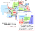
| 当前 | 2007年9月30日 (日) 05:48 |  | 900 × 800(34 KB) | Beagle.ja.wp | {{Information |Description={{ja|町区域の新設と変更の対照図<br />東京都港区・麻布地区}} |Source=self-made |Date=30 September 2007 |Author=Beagle |other_versions={{en|Image:Azabu_map_1962_en.png}} }} |
| 2007年9月30日 (日) 02:43 |  | 900 × 800(34 KB) | Beagle.ja.wp | {{Information |Description={{ja|町区域の新設と変更の対照図<br />東京都港区・麻布地区}} |Source=self-made |Date=30 September 2007 |Author=Beagle |other_versions={{en|Image:Azabu_map_1962_en.png}} }} |
文件用途
以下页面使用本文件:
全域文件用途
以下其他wiki使用此文件:
- ja.wikipedia.org上的用途


