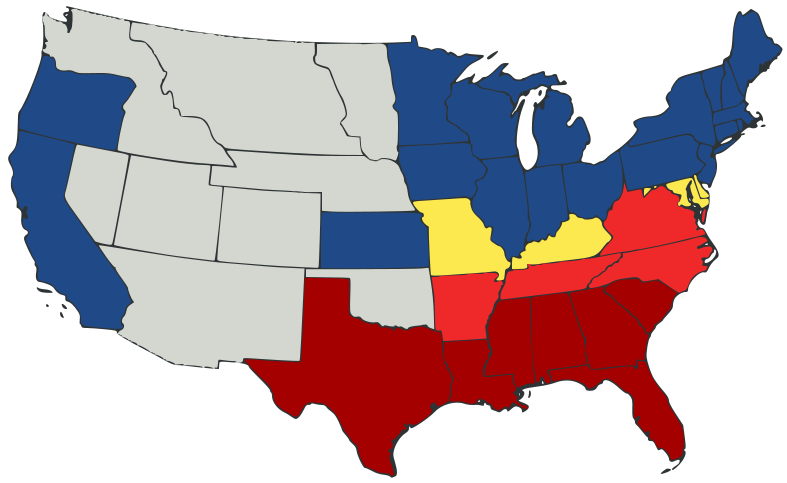
File:US Secession map 1861.svg
外观

此SVG文件的PNG预览的大小:787 × 483像素。 其他分辨率:320 × 196像素 | 640 × 393像素 | 1,024 × 628像素 | 1,280 × 786像素 | 2,560 × 1,571像素。
原始文件 (SVG文件,尺寸为787 × 483像素,文件大小:111 KB)
文件历史
点击某个日期/时间查看对应时刻的文件。
| 日期/时间 | 缩略图 | 大小 | 用户 | 备注 | |
|---|---|---|---|---|---|
| 当前 | 2007年2月23日 (五) 23:47 |  | 787 × 483(111 KB) | Tintazul | {{Tintazul |Description=United States map of 1861, show affiliation of states and territories regarding the Secession War (Civil War.) Legend: {{legend|#A40000|States that seceded before April 15, 1861}} {{legend|#EF2929|States that seceded after April 15 |
文件用途
以下页面使用本文件:
全域文件用途
以下其他wiki使用此文件:
- ar.wikipedia.org上的用途
- arz.wikipedia.org上的用途
- be.wikipedia.org上的用途
- bg.wikipedia.org上的用途
- bs.wikipedia.org上的用途
- cy.wikipedia.org上的用途
- da.wikipedia.org上的用途
- el.wikipedia.org上的用途
- en.wikipedia.org上的用途
- American Civil War
- Irredentism
- Origins of the American Civil War
- Border states (American Civil War)
- User:Jimmuldrow/Sandbox
- Upland South
- User:ArmyAnt/Sandbox
- Presidency of Abraham Lincoln
- Presidency of James Buchanan
- James Buchanan
- Central Confederacy
- User:2know4power/sandbox
- User:LukeRun82
- User:Orser67/Lincoln
- User:Falcaorib/Canada, United States and Mexico
- User:CaptainEek/Sandbox 3: Revenge of the Sand
- es.wikipedia.org上的用途
- eu.wikipedia.org上的用途
- gd.wikipedia.org上的用途
- he.wikipedia.org上的用途
- hr.wikipedia.org上的用途
- hy.wikipedia.org上的用途
- it.wikipedia.org上的用途
- ka.wikipedia.org上的用途
- lij.wikipedia.org上的用途
- lt.wikipedia.org上的用途
- ml.wikipedia.org上的用途
- ne.wikipedia.org上的用途
- no.wikipedia.org上的用途
- pl.wikipedia.org上的用途
查看此文件的更多全域用途。

