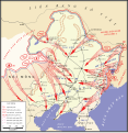
File:Manchuria Operation map.svg
外观

此SVG文件的PNG预览的大小:584 × 600像素。 其他分辨率:234 × 240像素 | 467 × 480像素 | 748 × 768像素 | 997 × 1,024像素 | 1,993 × 2,048像素 | 914 × 939像素。
原始文件 (SVG文件,尺寸为914 × 939像素,文件大小:462 KB)
文件历史
点击某个日期/时间查看对应时刻的文件。
| 日期/时间 | 缩略图 | 大小 | 用户 | 备注 | |
|---|---|---|---|---|---|
| 当前 | 2010年8月13日 (五) 10:48 |  | 914 × 939(462 KB) | Tazadeperla | Correction of location name (Tachienchang - Gonghexiang). |
| 2010年8月12日 (四) 14:13 |  | 914 × 939(457 KB) | Tazadeperla | Updating East Manchuria offensives | |
| 2010年8月11日 (三) 15:15 |  | 914 × 939(476 KB) | Tazadeperla | (Corecction of city names) | |
| 2010年8月11日 (三) 05:34 |  | 914 × 939(472 KB) | Tazadeperla | Corecction of city names. | |
| 2010年8月11日 (三) 04:03 |  | 914 × 939(467 KB) | Tazadeperla | Correction of typeface errors. | |
| 2010年8月11日 (三) 03:57 |  | 914 × 939(416 KB) | Tazadeperla | {{Information |Description={{en|1=Soviet Invasion of Manchuria (1945), based on Glantz's maps in Levenworth Paper No 7 - Feb 1983.}} |Source={{own}} |Author=Tazadeperla |Date= |Permission= |other_versions= }} |
文件用途
以下3个页面使用本文件:
全域文件用途
以下其他wiki使用此文件:
- ar.wikipedia.org上的用途
- az.wikipedia.org上的用途
- be.wikipedia.org上的用途
- en.wikipedia.org上的用途
- et.wikipedia.org上的用途
- fr.wikipedia.org上的用途
- he.wikipedia.org上的用途
- it.wikipedia.org上的用途
- ja.wikipedia.org上的用途
- ro.wikipedia.org上的用途
- uk.wikipedia.org上的用途
- vi.wikipedia.org上的用途
- www.wikidata.org上的用途


