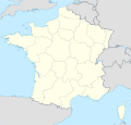
File:France location map.svg
外观

此SVG文件的PNG预览的大小:626 × 600像素。 其他分辨率:251 × 240像素 | 501 × 480像素 | 802 × 768像素 | 1,069 × 1,024像素 | 2,138 × 2,048像素 | 1,041 × 997像素。
原始文件 (SVG文件,尺寸为1,041 × 997像素,文件大小:643 KB)
文件历史
点击某个日期/时间查看对应时刻的文件。
| 日期/时间 | 缩略图 | 大小 | 用户 | 备注 | |
|---|---|---|---|---|---|
| 当前 | 2016年1月2日 (六) 09:43 |  | 1,041 × 997(643 KB) | Superbenjamin | New borders |
| 2012年10月2日 (二) 12:33 |  | 1,041 × 997(920 KB) | Palosirkka | Reverted to version as of 14:18, 7 July 2008 Location maps must remain very accurate | |
| 2012年10月2日 (二) 05:33 |  | 1,041 × 997(566 KB) | Palosirkka | Scrubbed with http://codedread.com/scour/ | |
| 2008年7月7日 (一) 14:18 |  | 1,041 × 997(920 KB) | NordNordWest | ||
| 2008年7月5日 (六) 18:05 |  | 1,041 × 997(920 KB) | NordNordWest | corrected | |
| 2008年7月2日 (三) 19:14 |  | 1,041 × 997(1.17 MB) | NordNordWest | ||
| 2008年7月2日 (三) 19:09 |  | 1,041 × 997(1.17 MB) | NordNordWest | {{Information |Description= {{de|Positionskarte von Frankreich}} Quadratische Plattkarte, N-S-Streckung 140 %. Geographische Begrenzung der Karte: * N: 51.6° N * S: 41.0° N * W: 5.3° W * O: 10.2° O {{en|Location map of [[:en:France| |
文件用途
以下3个页面使用本文件:
全域文件用途
以下其他wiki使用此文件:
- av.wikipedia.org上的用途
- ba.wikipedia.org上的用途
- bn.wikipedia.org上的用途
- ceb.wikipedia.org上的用途
- Beaulieu
- Beaumont
- Saint-Léger
- Entraigues-sur-la-Sorgue
- Orange
- Villenave-d'Ornon
- Osse-en-Aspe
- Les Eyzies-de-Tayac-Sireuil
- Quincerot, Côte-d'Or
- Courcelles
- Loguivy-Plougras
- Saint-Erblon, Ille-et-Vilaine
- Locmalo
- Chémery-sur-Bar
- Bourgogne (pagklaro)
- Ferrières
- Beaufort
- Montricher-Albanne
- Bonne
- Montendre
- Cauterets
- Castelmaurou
- Naives-Rosières
- Merlines
- Guémené-Penfao
- Gesté
- Belleau
- Lavalette
- La Chapelle
- Barby
- Gourdon
- Rouvroy
- Remicourt
- Rochefort
- Sainte-Foy, Saône-et-Loire
- Bray
- Villefranche
- Roche
查看此文件的更多全域用途。


