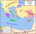
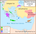
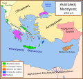
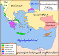
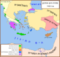
File:Eastern Mediterranean 1450.svg
外观

此SVG文件的PNG预览的大小:632 × 600像素。 其他分辨率:253 × 240像素 | 506 × 480像素 | 810 × 768像素 | 1,079 × 1,024像素 | 2,159 × 2,048像素 | 2,497 × 2,369像素。
原始文件 (SVG文件,尺寸为2,497 × 2,369像素,文件大小:265 KB)
文件历史
点击某个日期/时间查看对应时刻的文件。
| 日期/时间 | 缩略图 | 大小 | 用户 | 备注 | |
|---|---|---|---|---|---|
| 当前 | 2017年7月9日 (日) 12:40 |  | 2,497 × 2,369(265 KB) | Joe Roe | removed black outer border |
| 2013年8月6日 (二) 12:10 | 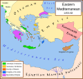 | 2,529 × 2,395(334 KB) | Phso2 | sporades | |
| 2013年7月1日 (一) 11:25 |  | 2,529 × 2,395(333 KB) | Phso2 | cf disc | |
| 2007年10月16日 (二) 16:15 |  | 2,529 × 2,395(333 KB) | MapMaster | small fix | |
| 2007年9月9日 (日) 18:56 |  | 2,529 × 2,395(332 KB) | MapMaster | Further slight changes, particularly Thessaloniki. | |
| 2007年9月9日 (日) 04:23 |  | 2,529 × 2,395(335 KB) | MapMaster | More changes based on Alekkas' research. | |
| 2007年9月7日 (五) 03:50 |  | 2,529 × 2,395(348 KB) | MapMaster | Slight modifications based on information from User:Alekkas on my talk page. | |
| 2007年4月17日 (二) 03:08 |  | 2,529 × 2,395(347 KB) | MapMaster | Added missing text | |
| 2007年4月14日 (六) 05:20 |  | 2,529 × 2,395(321 KB) | MapMaster | slight update | |
| 2007年4月13日 (五) 20:52 |  | 2,529 × 2,395(316 KB) | MapMaster | A political map of the eastern Mediterranean Sea, in 1450. |
文件用途
以下页面使用本文件:
全域文件用途
以下其他wiki使用此文件:
- ar.wikipedia.org上的用途
- ast.wikipedia.org上的用途
- azb.wikipedia.org上的用途
- az.wikipedia.org上的用途
- be.wikipedia.org上的用途
- bg.wikipedia.org上的用途
- bn.wikipedia.org上的用途
- bs.wikipedia.org上的用途
- ca.wikipedia.org上的用途
- cs.wikipedia.org上的用途
- de.wikipedia.org上的用途
- el.wikipedia.org上的用途
- en.wikipedia.org上的用途
- Constantine XI Palaiologos
- Succession of the Roman Empire
- Karamanids
- Imbros
- Duchy of the Archipelago
- House of Lusignan
- Giosafat Barbaro
- User:MapMaster
- History of the Republic of Venice
- Knights Hospitaller
- Byzantine–Ottoman wars
- Hospitaller Rhodes
- Frankokratia
- Byzantine Empire
- Stato da Màr
- History of the Byzantine Empire
- Ottoman–Venetian War (1463–1479)
- Morea revolt of 1453–1454
查看此文件的更多全域用途。


