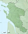
File:Charente-Maritime department relief location map.jpg
外观

本预览的尺寸:499 × 600像素。 其他分辨率:200 × 240像素 | 399 × 480像素 | 942 × 1,132像素。
原始文件 (942 × 1,132像素,文件大小:282 KB,MIME类型:image/jpeg)
文件历史
点击某个日期/时间查看对应时刻的文件。
| 日期/时间 | 缩略图 | 大小 | 用户 | 备注 | |
|---|---|---|---|---|---|
| 当前 | 2010年7月18日 (日) 13:45 |  | 942 × 1,132(282 KB) | Sting | Color profile |
| 2008年10月15日 (三) 02:38 |  | 942 × 1,132(335 KB) | Sting | == Summary == {{Location|45|44|15|N|00|46|30|W|scale:1000000}} <br/> {{Information |Description={{en|Blank physical map of the department of Charente-Maritime, France, for geo-location purpose, with distinct boundaries for region |
文件用途
全域文件用途
以下其他wiki使用此文件:
- als.wikipedia.org上的用途
- ar.wikipedia.org上的用途
- ast.wikipedia.org上的用途
- bn.wikipedia.org上的用途
- ceb.wikipedia.org上的用途
- cs.wikipedia.org上的用途
- cy.wikipedia.org上的用途
- de.wikipedia.org上的用途
- en.wikipedia.org上的用途
- eo.wikipedia.org上的用途
- es.wikipedia.org上的用途
- fa.wikipedia.org上的用途
- fr.wikipedia.org上的用途
- Charente-Maritime
- Saint-Jean-d'Angély
- La Rochelle
- Hiers-Brouage
- Bois (Charente-Maritime)
- Clérac
- Tonnay-Charente
- Agudelle
- Aigrefeuille-d'Aunis
- Allas-Bocage
- Allas-Champagne
- Anais (Charente-Maritime)
- Burie
- Talmont-sur-Gironde
- Géographie de la Charente-Maritime
- Saintes
- Chaniers
- Soulignonne
- Cozes
- Gémozac
- Saint-Loup (Charente-Maritime)
- Arces (Charente-Maritime)
- Épargnes
查看此文件的更多全域用途。


