File:Barents Sea map.png
外观

本预览的尺寸:657 × 600像素。 其他分辨率:263 × 240像素 | 526 × 480像素 | 841 × 768像素 | 1,187 × 1,084像素。
原始文件 (1,187 × 1,084像素,文件大小:654 KB,MIME类型:image/png)
文件历史
点击某个日期/时间查看对应时刻的文件。
| 日期/时间 | 缩略图 | 大小 | 用户 | 备注 | |
|---|---|---|---|---|---|
| 当前 | 2012年3月29日 (四) 20:52 | 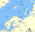 | 1,187 × 1,084(654 KB) | Ras67 | cropped |
| 2006年2月5日 (日) 06:11 |  | 1,200 × 1,098(680 KB) | Berkut~commonswiki | pngout-ed (13% file size reduction) | |
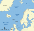
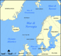
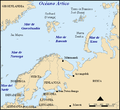
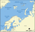
| 2005年11月25日 (五) 16:40 |  | 1,200 × 1,098(781 KB) | NormanEinstein | This map shows the location of the Barents Sea north of Russia and Norway, and the surrounding seas and islands. Created by NormanEinstein, November 25, 2005. {{GFDL-self}} Category:Maps of seas |
文件用途
以下页面使用本文件:
全域文件用途
以下其他wiki使用此文件:
- af.wikipedia.org上的用途
- ar.wikipedia.org上的用途
- arz.wikipedia.org上的用途
- ast.wikipedia.org上的用途
- azb.wikipedia.org上的用途
- bcl.wikipedia.org上的用途
- be-tarask.wikipedia.org上的用途
- bg.wikipedia.org上的用途
- bn.wikipedia.org上的用途
- bs.wikipedia.org上的用途
- ca.wikipedia.org上的用途
- cs.wikipedia.org上的用途
- cs.wikinews.org上的用途
- da.wikipedia.org上的用途
- de.wiktionary.org上的用途
- el.wikipedia.org上的用途
- en.wikipedia.org上的用途
- Barents Sea
- User:NormanEinstein/gallery
- Keith Jessop
- Convoy PQ 1
- Convoy PQ 2
- Convoy PQ 18
- Gyda Peninsula
- Fishing industry in Russia
- Operation Fritham
- List of Russian explorers
- Convoy PQ 12
- Convoy PQ 11
- Convoy PQ 9/10
- Convoy PQ 8
- Convoy JW 51A
- Convoy JW 51B
- Arctic naval operations of World War II
- Convoy QP 14
- Convoy QP 15
- List of oil and gas fields of the Barents Sea
- Operation Orator
- Barents Sea submarine campaign (1941)
- Operation Gearbox
- Operation Gearbox II
- Convoy QP 1
- Atlantification of the Arctic
- en.wikisource.org上的用途
- en.wiktionary.org上的用途
- eo.wikipedia.org上的用途
- es.wikipedia.org上的用途
- eu.wikipedia.org上的用途
查看此文件的更多全域用途。


